Wesburn, Victoria
| Wesburn Victoria | |||||||||||||||
|---|---|---|---|---|---|---|---|---|---|---|---|---|---|---|---|
 The Warburton Highway passing through Wesburn on its way to Melbourne. The Sam Knott Hotel can be seen to the left. | |||||||||||||||
 | |||||||||||||||
| Coordinates | 37°46′01″S 145°38′49″E / 37.767°S 145.647°E | ||||||||||||||
| Population | 1,052 (2021 census)[1] | ||||||||||||||
| Postcode(s) | 3799 | ||||||||||||||
| Elevation | 257 m (843 ft) | ||||||||||||||
| Location | |||||||||||||||
| LGA(s) | Shire of Yarra Ranges | ||||||||||||||
| State electorate(s) | Eildon | ||||||||||||||
| Federal division(s) | McEwen | ||||||||||||||
| |||||||||||||||
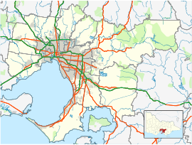
Wesburn is a town in Victoria, Australia, 62 km east from Melbourne's central business district, located within the Shire of Yarra Ranges local government area. Wesburn recorded a population of 1,052 at the 2021 census.[1]
Predominantly rural in nature, the township has a narrow ribbon of residential dwellings along and branching off the Warburton Highway.
The name Wesburn is derived from its original name of West Warburton. Warburton West Post Office opened on 7 February 1893, was renamed Wesburn in 1925 and closed in 1993.[2] Wesburn was also served by a railway station on the former Warburton railway line until closure in 1965. Today the former railway line has been transformed into a walking and cycling path called the Warburton Trail.
Wesburn Primary School opened in 1904 after relocation of the building from Millgrove.[3] The school has a current enrolment of around 100 and is a participant in the Stephanie Alexander Kitchen Garden program.[4]
The Wesburn Recreation Reserve hosts junior football and netball teams. The township is also serviced by a pub and a number of small shops. Public transport is provided by bus route from Warburton to Chirnside Park.
References
[edit]- ^ a b "2021 Census QuickStats Wesburn". Australian Bureau of Statistics. Retrieved 9 July 2022.
- ^ Phoenix Auctions History, Post Office List, retrieved 3 February 2021
- ^ Wesburn Primary School History
- ^ "Home". kitchengardenfoundation.org.au.
External links
[edit]![]() Media related to Wesburn at Wikimedia Commons
Media related to Wesburn at Wikimedia Commons


